
Thank you for supporting this site ❤️
Make a donation
Make a donation
Grandson topographic map
Click on the map to display elevation.
Thank you for supporting this site ❤️
Make a donation
Make a donation
Grandson
Grandson lies at an elevation of 447 m (1,467 ft), at a distance of 3 km (1.9 mi) north of Yverdon-les-Bains.
Thank you for supporting this site ❤️
Make a donation
Make a donation
About this map
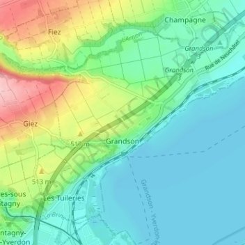
Name: Grandson topographic map, elevation, terrain.
Location: Grandson, District du Jura-Nord vaudois, Vaud, 1422, Switzerland (46.79397 6.61900 46.82971 6.69292)
Average elevation: 469 m
Minimum elevation: 422 m
Maximum elevation: 649 m
Thank you for supporting this site ❤️
Make a donation
Make a donation
Other topographic maps
Click on a map to view its topography, its elevation and its terrain.