
Thank you for supporting this site ❤️
Make a donation
Make a donation
Gimcheon topographic map
Click on the map to display elevation.
Thank you for supporting this site ❤️
Make a donation
Make a donation
Gimcheon
Mt. Hwangaksan (1,111m in elevation), home of Jikjisa, is located in the Sobaeksan Mountains. The area is a habitat for many cranes that reside on this mountain. This location is also known for its pine forests, streams, fall foliage and snowscapes.
Thank you for supporting this site ❤️
Make a donation
Make a donation
About this map
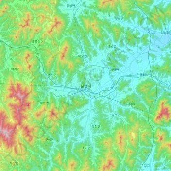
Name: Gimcheon topographic map, elevation, terrain.
Location: Gimcheon, Gimcheon-si, North Gyeongsang, 39547, South Korea (35.97980 127.95395 36.29980 128.27395)
Average elevation: 263 m
Minimum elevation: 34 m
Maximum elevation: 1,156 m
Thank you for supporting this site ❤️
Make a donation
Make a donation
Other topographic maps
Click on a map to view its topography, its elevation and its terrain.