
Făgăraș topographic map
Interactive map
Click on the map to display elevation.
About this map
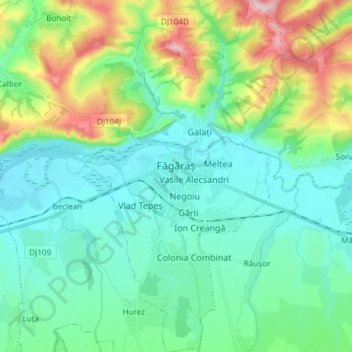
Name: Făgăraș topographic map, elevation, terrain.
Location: Făgăraș, Brașov, 505200, Roemenië (45.78970 24.93145 45.89365 25.01867)
Average elevation: 476 m
Minimum elevation: 418 m
Maximum elevation: 652 m