
Outer Cove topographic map
Click on the map to display elevation.
About this map
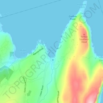
Name: Outer Cove topographic map, elevation, terrain.
Average elevation: 47 m
Minimum elevation: -1 m
Maximum elevation: 188 m
Other topographic maps
Click on a map to view its topography, its elevation and its terrain.
Middle Cove
Canada > Newfoundland and Labrador > Logy Bay-Middle Cove-Outer Cove
Average elevation: 41 m