
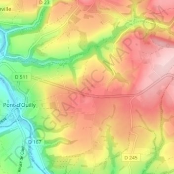
Le Bourg d'Ouilly topographic map
Interactive map
Click on the map to display elevation.
About this map
Name: Le Bourg d'Ouilly topographic map, elevation, terrain.
Average elevation: 154 m
Minimum elevation: 43 m
Maximum elevation: 250 m
Other topographic maps
Click on a map to view its topography, its elevation and its terrain.
La Valette
France > Normandie > Calvados > Pont-d'Ouilly
La Valette, Pont-d'Ouilly, Caen, Calvados, Normandie, France métropolitaine, 14690, France
Average elevation: 122 m
Le Caprice
France > Normandie > Calvados > Pont-d'Ouilly
Le Caprice, Pont-d'Ouilly, Caen, Calvados, Normandie, France métropolitaine, 14690, France
Average elevation: 115 m
Le Grand Clos
France > Normandie > Calvados > Pont-d'Ouilly
Le Grand Clos, Pont-d'Ouilly, Caen, Calvados, Normandie, France métropolitaine, 14690, France
Average elevation: 112 m