
Thank you for supporting this site ❤️
Make a donation
Make a donation
Casale topographic map
Click on the map to display elevation.
Thank you for supporting this site ❤️
Make a donation
Make a donation
About this map
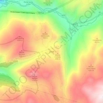
Name: Casale topographic map, elevation, terrain.
Location: Casale, Foligno, Perugia, Umbria, 06034, Italia (42.94202 12.77726 42.98202 12.81726)
Average elevation: 812 m
Minimum elevation: 339 m
Maximum elevation: 1,202 m
Thank you for supporting this site ❤️
Make a donation
Make a donation
Other topographic maps
Click on a map to view its topography, its elevation and its terrain.