
Thank you for supporting this site ❤️
Make a donation
Make a donation
Havert topographic map
Click on the map to display elevation.
Thank you for supporting this site ❤️
Make a donation
Make a donation
Havert
Havert ligt in de vallei van de Saeffeler Bach op een hoogte van ongeveer 46 meter.
Thank you for supporting this site ❤️
Make a donation
Make a donation
About this map
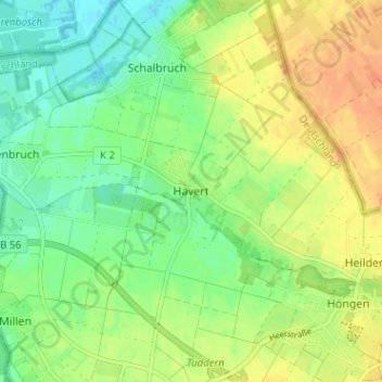
Name: Havert topographic map, elevation, terrain.
Average elevation: 46 m
Minimum elevation: 30 m
Maximum elevation: 63 m
Thank you for supporting this site ❤️
Make a donation
Make a donation