
Ko Phra Wat Noi topographic map
Interactive map
Click on the map to display elevation.
About this map
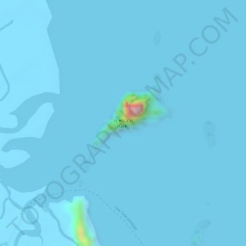
Name: Ko Phra Wat Noi topographic map, elevation, terrain.
Location: Ko Phra Wat Noi, Phangnga Province, Thailand (8.24252 98.46411 8.25349 98.47418)
Average elevation: 4 m
Minimum elevation: -5 m
Maximum elevation: 286 m
Other topographic maps
Click on a map to view its topography, its elevation and its terrain.
Ko Song Phi Nong
Ko Song Phi Nong, Phangnga Province, Thailand
Average elevation: 4 m
Ko Similan (No. 8)
Ko Similan (No. 8), Phangnga Province, Thailand
Average elevation: 18 m