
Valley County topographic map
Interactive map
Click on the map to display elevation.
About this map
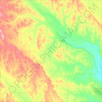
Name: Valley County topographic map, elevation, terrain.
Location: Valley County, Nebraska, United States (41.39262 -99.21476 41.74054 -98.75082)
Average elevation: 670 m
Minimum elevation: 588 m
Maximum elevation: 787 m
Other topographic maps
Click on a map to view its topography, its elevation and its terrain.
Omaha
United States > Nebraska > Douglas County > Omaha
Omaha, Douglas County, Nebraska, 68183, United States
Average elevation: 339 m
Omaha
United States > Nebraska > Douglas County
Omaha, Douglas County, Nebraska, United States
Average elevation: 338 m