
Calanca topographic map
Interactive map
Click on the map to display elevation.
About this map
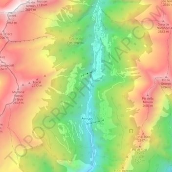
Name: Calanca topographic map, elevation, terrain.
Location: Calanca, Moësa, Grisons, 6543, Suisse (46.28415 9.06431 46.34515 9.16219)
Average elevation: 1,757 m
Minimum elevation: 740 m
Maximum elevation: 2,913 m
Other topographic maps
Click on a map to view its topography, its elevation and its terrain.
Val di Cranon
Val di Cranon, Calanca, Moësa, Grisons, 6543, Suisse
Average elevation: 1,780 m