
Province of Ilo topographic map
Interactive map
Click on the map to display elevation.
About this map
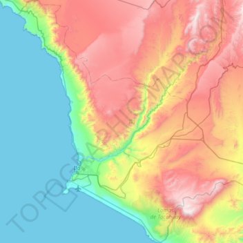
Name: Province of Ilo topographic map, elevation, terrain.
Location: Province of Ilo, Moquegua, Peru (-17.82148 -71.49080 -17.25172 -70.90717)
Average elevation: 652 m
Minimum elevation: 0 m
Maximum elevation: 1,803 m
Other topographic maps
Click on a map to view its topography, its elevation and its terrain.