
Rouvreux topographic map
Interactive map
Click on the map to display elevation.
About this map
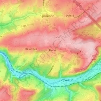
Name: Rouvreux topographic map, elevation, terrain.
Location: Rouvreux, Sprimont, Luik, Wallonië, 4140, België (50.47650 5.63175 50.50239 5.70531)
Average elevation: 228 m
Minimum elevation: 105 m
Maximum elevation: 316 m
Other topographic maps
Click on a map to view its topography, its elevation and its terrain.