
Alghero - L'Alguer topographic map
Interactive map
Click on the map to display elevation.
About this map
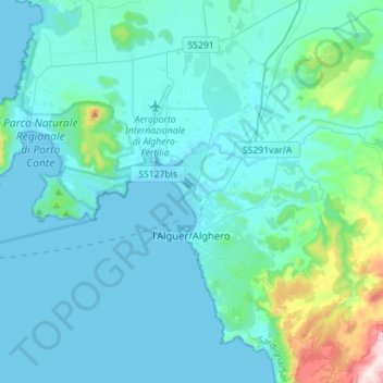
Name: Alghero - L'Alguer topographic map, elevation, terrain.
Location: Alghero - L'Alguer, SS, Sardenha, Itália (40.49496 8.13777 40.67399 8.42032)
Average elevation: 74 m
Minimum elevation: -1 m
Maximum elevation: 704 m