
Cancal topographic map
Interactive map
Click on the map to display elevation.
About this map
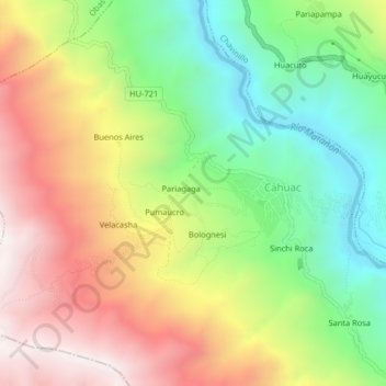
Name: Cancal topographic map, elevation, terrain.
Location: Cancal, Cahuac, Yarowilca, Huánuco, Pérou (-9.87336 -76.66007 -9.83336 -76.62007)
Average elevation: 3,627 m
Minimum elevation: 3,098 m
Maximum elevation: 4,243 m