
Köping topographic map
Interactive map
Click on the map to display elevation.
About this map
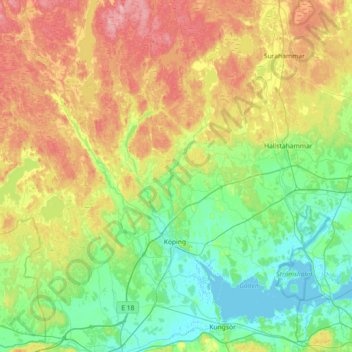
Name: Köping topographic map, elevation, terrain.
Location: Köping, Comté de Västmanland, Svealand, Suède (59.44750 15.51255 59.71298 16.23577)
Average elevation: 56 m
Minimum elevation: -2 m
Maximum elevation: 158 m
Other topographic maps
Click on a map to view its topography, its elevation and its terrain.
Västerås
Suède > Comté de Västmanland > Västerås
Västerås, Västerås kommun, Comté de Västmanland, Svealand, 721 01, Suède
Average elevation: 28 m
Västerås
Västerås, Comté de Västmanland, Svealand, Suède
Average elevation: 33 m