
Monsey topographic map
Interactive map
Click on the map to display elevation.
About this map
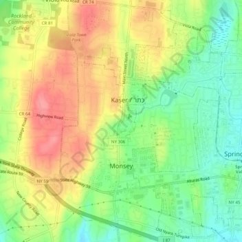
Name: Monsey topographic map, elevation, terrain.
Average elevation: 172 m
Minimum elevation: 132 m
Maximum elevation: 214 m
Other topographic maps
Click on a map to view its topography, its elevation and its terrain.
Village of Spring Valley
United States > New York > Rockland County
Village of Spring Valley, Town of Ramapo, Rockland County, New York, 10977, United States
Average elevation: 149 m