
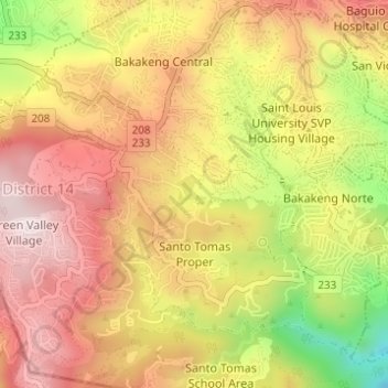
Santo Thomas Proper topographic map
Interactive map
Click on the map to display elevation.
About this map
Name: Santo Thomas Proper topographic map, elevation, terrain.
Average elevation: 1,392 m
Minimum elevation: 1,083 m
Maximum elevation: 1,598 m
Other topographic maps
Click on a map to view its topography, its elevation and its terrain.
Santo Rosario
Philippines > Baguio > Tuba
Santo Rosario, District 4, Tuba, Baguio, Cordillera Administrative Region, 2600, Philippines
Average elevation: 1,426 m
San Luis Village
Philippines > Baguio > Tuba
San Luis Village, Tuba, Baguio, Cordillera Administrative Region, 2603, Philippines
Average elevation: 1,403 m