
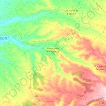
Montornès de Segarra topographic map
Interactive map
Click on the map to display elevation.
About this map
Name: Montornès de Segarra topographic map, elevation, terrain.
Location: Montornès de Segarra, Segarra, Lleida, Catalonia, 25340, Spain (41.58537 1.16720 41.61252 1.25330)
Average elevation: 595 m
Minimum elevation: 458 m
Maximum elevation: 747 m
Other topographic maps
Click on a map to view its topography, its elevation and its terrain.