
Town of Amenia topographic map
Interactive map
Click on the map to display elevation.
About this map
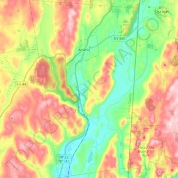
Name: Town of Amenia topographic map, elevation, terrain.
Location: Town of Amenia, Dutchess County, New York, United States (41.74995 -73.61480 41.88828 -73.50010)
Average elevation: 256 m
Minimum elevation: 117 m
Maximum elevation: 430 m
Other topographic maps
Click on a map to view its topography, its elevation and its terrain.
Town of Pawling
United States > New York > Dutchess County
Town of Pawling, Dutchess County, New York, United States
Average elevation: 243 m
Town of Union Vale
United States > New York > Dutchess County
Town of Union Vale, Dutchess County, New York, 12585, United States
Average elevation: 227 m