
Mount Chamah topographic map
Interactive map
Click on the map to display elevation.
Mount Chamah
Gunung Chamah lies in the north-western corner of Kelantan and is the fifth highest mountain in Peninsular Malaysia. It is one of the Peninsula's G7 (mountains above 7,000 ft/2,134m). Gunung in Malay literally means mountains with an elevation of 1,000 m and above. In Peninsular Malaysia, there are several of these mountains located along the main mountain ranges called the Titiwangsa Range. On one of these popular mountain peaks is the Gunung Chamah with an elevation of 2,171m.
About this map
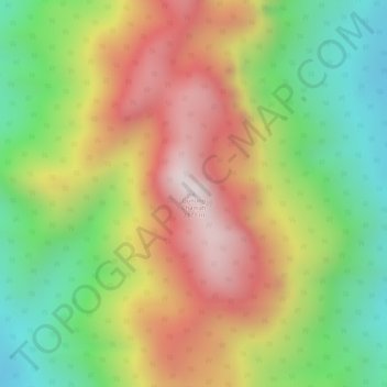
Name: Mount Chamah topographic map, elevation, terrain.
Location: Mount Chamah, Gua Musang, Kelantan, Malaysia (5.22724 101.57389 5.22734 101.57399)
Average elevation: 1,810 m
Minimum elevation: 1,479 m
Maximum elevation: 2,145 m
Other topographic maps
Click on a map to view its topography, its elevation and its terrain.