
Bischofswerda topographic map
Interactive map
Click on the map to display elevation.
About this map
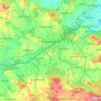
Name: Bischofswerda topographic map, elevation, terrain.
Location: Bischofswerda, Bautzen, Saxony, 01877, Germany (51.06635 14.12055 51.17064 14.23004)
Average elevation: 314 m
Minimum elevation: 228 m
Maximum elevation: 478 m