
Lago Ontario topographic map
Interactive map
Click on the map to display elevation.
About this map
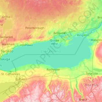
Name: Lago Ontario topographic map, elevation, terrain.
Location: Lago Ontario, Quinte West, Central Ontario, Ontario, Canadá (43.15936 -79.92534 44.36087 -76.00101)
Average elevation: 215 m
Minimum elevation: 70 m
Maximum elevation: 679 m