
Tumana topographic map
Interactive map
Click on the map to display elevation.
About this map
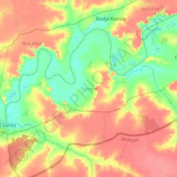
Name: Tumana topographic map, elevation, terrain.
Location: Tumana, Basse, Upper River Division, The Gambia (13.27976 -14.20913 13.45557 -13.94278)
Average elevation: 31 m
Minimum elevation: 2 m
Maximum elevation: 61 m