
Pinespark topographic map
Interactive map
Click on the map to display elevation.
About this map
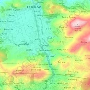
Name: Pinespark topographic map, elevation, terrain.
Average elevation: 1,418 m
Minimum elevation: 1,265 m
Maximum elevation: 1,653 m
Other topographic maps
Click on a map to view its topography, its elevation and its terrain.
Central Pico
Philippines > Benguet > Pinespark
Central Pico, Pinespark, La Trinidad, Benguet, Cordillera Administrative Region, 2601, Philippines
Average elevation: 1,393 m