
Maizuru topographic map
Interactive map
Click on the map to display elevation.
About this map
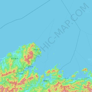
Name: Maizuru topographic map, elevation, terrain.
Location: Maizuru, Kyoto Prefecture, Kinki Region, Japan (35.38003 135.15926 36.10319 135.67954)
Average elevation: 62 m
Minimum elevation: -3 m
Maximum elevation: 809 m
Other topographic maps
Click on a map to view its topography, its elevation and its terrain.