
Base Peak topographic map
Interactive map
Click on the map to display elevation.
About this map
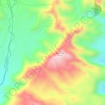
Name: Base Peak topographic map, elevation, terrain.
Average elevation: 439 m
Minimum elevation: 276 m
Maximum elevation: 618 m
Other topographic maps
Click on a map to view its topography, its elevation and its terrain.
Siguel River
Philippines > South Cotabato > General Santos
Siguel River, General Santos, South Cotabato, Soccsksargen, Philippines
Average elevation: 555 m
General Santos
Philippines > South Cotabato > General Santos
General Santos, South Cotabato, Soccsksargen, 9500, Philippines
Average elevation: 149 m
Silway River
Philippines > South Cotabato > General Santos
Silway River, General Santos, South Cotabato, Soccsksargen, 9500, Philippines
Average elevation: 280 m
Nopol Hill
Philippines > South Cotabato > General Santos
Nopol Hill, General Santos, South Cotabato, Soccsksargen, 9500, Philippines
Average elevation: 429 m