
Al Naseem District Eastحي النسيم الشرقي topographic map
Interactive map
Click on the map to display elevation.
About this map
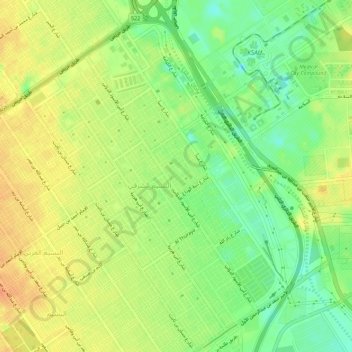
Name: Al Naseem District Eastحي النسيم الشرقي topographic map, elevation, terrain.
Average elevation: 583 m
Minimum elevation: 562 m
Maximum elevation: 600 m
Other topographic maps
Click on a map to view its topography, its elevation and its terrain.
Al Naseem Municipality
Al Naseem Municipality, النسيم, Provincia de Riad, 11433, Arabia Saudita
Average elevation: 591 m