
Årjängs kommun topographic map
Interactive map
Click on the map to display elevation.
About this map
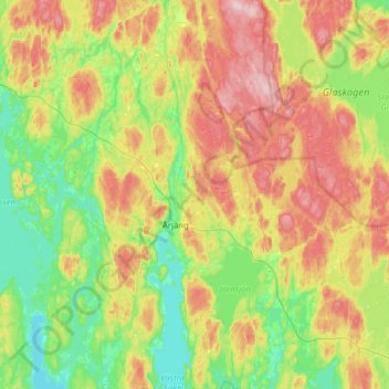
Name: Årjängs kommun topographic map, elevation, terrain.
Location: Årjängs kommun, Värmland County, Sweden (59.25667 12.00667 59.57667 12.32667)
Average elevation: 179 m
Minimum elevation: 94 m
Maximum elevation: 325 m