
Washoe City topographic map
Interactive map
Click on the map to display elevation.
About this map
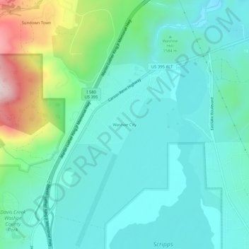
Name: Washoe City topographic map, elevation, terrain.
Location: Washoe City, Washoe County, Nevada, USA (39.30019 -119.82963 39.34019 -119.78963)
Average elevation: 1,595 m
Minimum elevation: 1,502 m
Maximum elevation: 1,927 m