
Colón topographic map
Interactive map
Click on the map to display elevation.
About this map
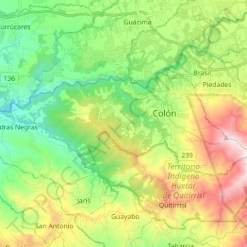
Name: Colón topographic map, elevation, terrain.
Location: Colón, Cantón Mora, Provincia San José, 10701, Costa Rica (9.88384 -84.32499 9.93542 -84.19909)
Average elevation: 845 m
Minimum elevation: 397 m
Maximum elevation: 1,628 m