
Birmingham topographic map
Interactive map
Click on the map to display elevation.
About this map
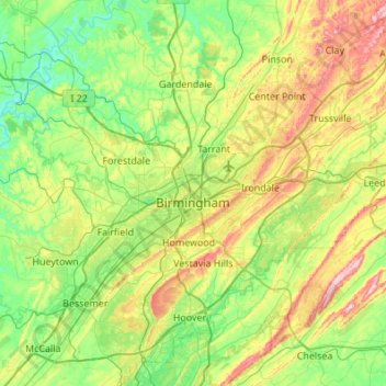
Name: Birmingham topographic map, elevation, terrain.
Location: Birmingham, Jefferson County, Alabama, United States (33.38421 -87.12264 33.67859 -86.57831)
Average elevation: 193 m
Minimum elevation: 79 m
Maximum elevation: 457 m