
Staten Island topographic map
Interactive map
Click on the map to display elevation.
About this map
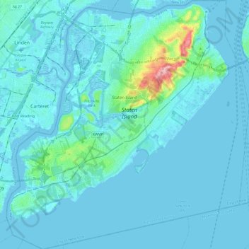
Name: Staten Island topographic map, elevation, terrain.
Location: Staten Island, Richmond County, New York, USA (40.49603 -74.25568 40.64889 -74.04925)
Average elevation: 11 m
Minimum elevation: -5 m
Maximum elevation: 122 m