
Tanauan topographic map
Interactive map
Click on the map to display elevation.
About this map
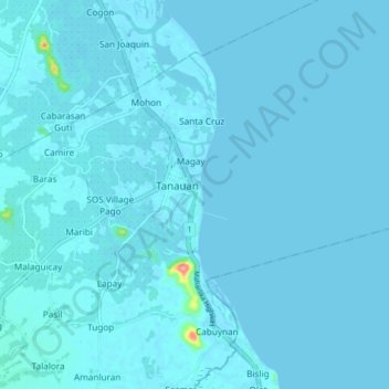
Name: Tanauan topographic map, elevation, terrain.
Average elevation: 3 m
Minimum elevation: -1 m
Maximum elevation: 98 m
Other topographic maps
Click on a map to view its topography, its elevation and its terrain.
San Miguel
Philippines > Leyte > Tanauan > SOS Village Pago
San Miguel, SOS Village Pago, Tanauan, Leyte 1st District, Leyte, Eastern Visayas, 6502, Philippines
Average elevation: 6 m
o
Philippines > Leyte > Tanauan
o, Tanauan, Leyte 1st District, Leyte, Eastern Visayas, 6502, Philippines
Average elevation: 7 m