
Schänis topographic map
Interactive map
Click on the map to display elevation.
About this map
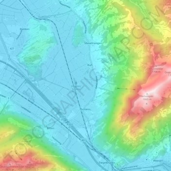
Name: Schänis topographic map, elevation, terrain.
Location: Schänis, Wahlkreis See-Gaster, Sankt Gallen, Switzerland (47.12981 9.00807 47.21104 9.12282)
Average elevation: 725 m
Minimum elevation: 407 m
Maximum elevation: 1,844 m