
Ottawa topographic map
Interactive map
Click on the map to display elevation.
About this map
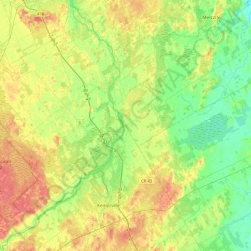
Name: Ottawa topographic map, elevation, terrain.
Location: Rideau Township, Ottawa, Ontario, Canada (44.96177 -75.95309 45.25646 -75.61852)
Average elevation: 92 m
Minimum elevation: 70 m
Maximum elevation: 121 m
Other topographic maps
Click on a map to view its topography, its elevation and its terrain.
Cumberland
Canada > Ontario > Ottawa > Cumberland
Cumberland, Ottawa, Eastern Ontario, Ontario, Canada
Average elevation: 75 m
Alta Vista
Alta Vista, (Old) Ottawa, Ottawa, Ontario, Canada
Average elevation: 77 m