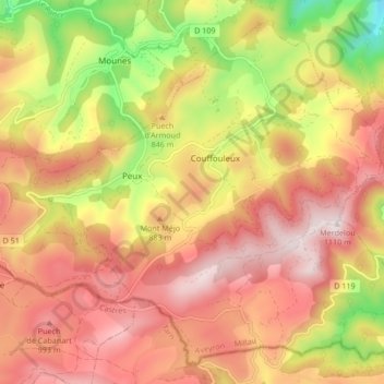
Peux-et-Couffouleux topographic map
Interactive map
Click on the map to display elevation.
About this map
Name: Peux-et-Couffouleux topographic map, elevation, terrain.
Average elevation: 824 m
Minimum elevation: 437 m
Maximum elevation: 1,101 m

Click on the map to display elevation.
Name: Peux-et-Couffouleux topographic map, elevation, terrain.
Average elevation: 824 m
Minimum elevation: 437 m
Maximum elevation: 1,101 m