
Barnstable topographic map
Interactive map
Click on the map to display elevation.
About this map
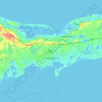
Name: Barnstable topographic map, elevation, terrain.
Location: Barnstable, Barnstable County, Massachusetts, United States (41.54852 -70.46760 41.79328 -70.25963)
Average elevation: 6 m
Minimum elevation: -6 m
Maximum elevation: 75 m