
North Union Township topographic map
Interactive map
Click on the map to display elevation.
About this map
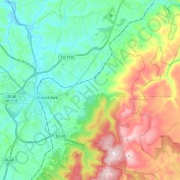
Name: North Union Township topographic map, elevation, terrain.
Average elevation: 447 m
Minimum elevation: 275 m
Maximum elevation: 815 m
The eastern half of Union Township occupies the hilltops and western slope of Chestnut Ridge, with the highest elevation of 2,670 feet (810 m) located near the southeast corner of the township, just north of the Summit Hotel. The lowest point in the township is 910 feet (280 m) above sea level, along Redstone Creek where it exits the township from its northwest corner.