
Becerreá topographic map
Interactive map
Click on the map to display elevation.
About this map
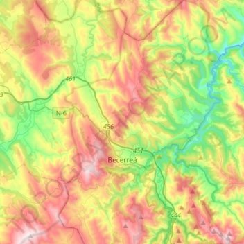
Name: Becerreá topographic map, elevation, terrain.
Location: Becerreá, Ancares, Lugo, Galicia, España (42.78785 -7.23071 42.98039 -7.05543)
Average elevation: 705 m
Minimum elevation: 322 m
Maximum elevation: 1,197 m
Other topographic maps
Click on a map to view its topography, its elevation and its terrain.