
Boracay Island topographic map
Interactive map
Click on the map to display elevation.
About this map
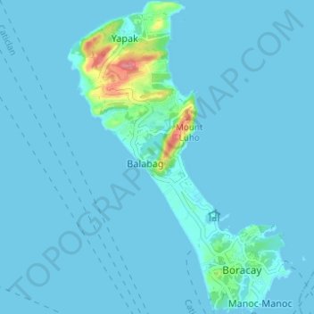
Name: Boracay Island topographic map, elevation, terrain.
Location: Boracay Island, Malay, Aklan, Western Visayas, Philippines (11.93925 121.90505 11.99944 121.94932)
Average elevation: 6 m
Minimum elevation: 0 m
Maximum elevation: 91 m
Other topographic maps
Click on a map to view its topography, its elevation and its terrain.