
Tokyo topographic map
Interactive map
Click on the map to display elevation.
About this map
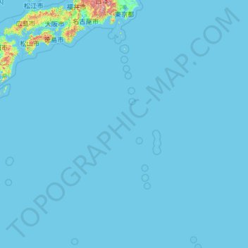
Name: Tokyo topographic map, elevation, terrain.
Location: Tokyo, Japan (20.21458 135.85369 35.89842 154.20554)
Average elevation: 22 m
Minimum elevation: -3 m
Maximum elevation: 3,459 m
The mainland portion of Tokyo lies northwest of Tokyo Bay and measures about 90 km (56 mi) east to west and 25 km (16 mi) north to south. The average elevation in Tokyo is 40 m (131 ft). Chiba Prefecture borders it to the east, Yamanashi to the west, Kanagawa to the south, and Saitama to the north. Mainland Tokyo is further subdivided into the special wards (occupying the eastern half) and the Tama area (多摩地域) stretching westwards.
Other topographic maps
Click on a map to view its topography, its elevation and its terrain.
Kutchan
Kutchan, Abuta County, Shiribeshi Subprefecture, Hokkaido Prefecture, Japan
Average elevation: 374 m
Yamanouchi
Yamanouchi, Shimotakai County, Nagano Prefecture, Chubu Region, Japan
Average elevation: 942 m
Wadomari
Wadomari, Oshima County, Kagoshima Prefecture, Japan
Average elevation: 3 m
Taku-shima Island
Taku-shima Island, Hirado, Nagasaki Prefecture, Japan
Average elevation: 8 m
Hara
Japan > Suwa County > Hara
Hara, Suwa County, Nagano Prefecture, 391-0104, Japan
Average elevation: 1,235 m
Toyohashi
Toyohashi, Aichi Prefecture, Chubu Region, Japan
Average elevation: 17 m