
1st District topographic map
Interactive map
Click on the map to display elevation.
About this map
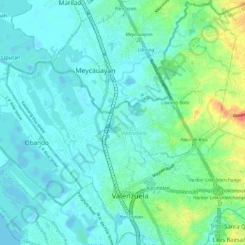
Name: 1st District topographic map, elevation, terrain.
Average elevation: 11 m
Minimum elevation: -4 m
Maximum elevation: 52 m
Other topographic maps
Click on a map to view its topography, its elevation and its terrain.
2nd District
2nd District, Valenzuela, Northern Manila District, Metro Manila, Philippines
Average elevation: 21 m
Malinta
Malinta, 1st District, Valenzuela, Northern Manila District, Metro Manila, 1441, Philippines
Average elevation: 8 m