
Elbow River topographic map
Interactive map
Click on the map to display elevation.
About this map
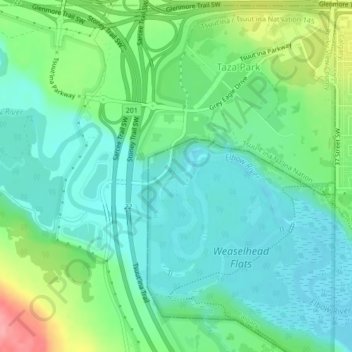
Name: Elbow River topographic map, elevation, terrain.
Location: Elbow River, Calgary, Alberta, T3E 1H2, Canada (50.99418 -114.16282 50.99676 -114.15861)
Average elevation: 1,100 m
Minimum elevation: 1,072 m
Maximum elevation: 1,170 m
Other topographic maps
Click on a map to view its topography, its elevation and its terrain.