
Melukote topographic map
Interactive map
Click on the map to display elevation.
About this map
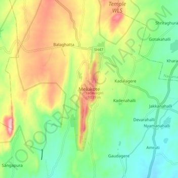
Name: Melukote topographic map, elevation, terrain.
Average elevation: 920 m
Minimum elevation: 802 m
Maximum elevation: 1,111 m
Other topographic maps
Click on a map to view its topography, its elevation and its terrain.
Yadavagiri
India > Karnataka > Pandavapura taluk > Melukote
Yadavagiri, Melukote, Pandavapura taluk, Mandya district, Karnataka, 571431, India
Average elevation: 946 m