
Cagayancillo topographic map
Interactive map
Click on the map to display elevation.
Cagayancillo
There are neither mountain ranges nor forested areas in the municipality. A hilly portion in the north-eastern part of the main island has a slope of 3-82%. The other areas are flat with the highest elevation around 2 to 3 meters. The majority of the island has a sandy loam soil not enough to support a forest.
About this map
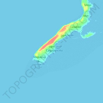
Name: Cagayancillo topographic map, elevation, terrain.
Location: Cagayancillo, Palawan, Mimaropa, 5321, Philippines (9.53691 121.15715 9.61691 121.23715)
Average elevation: 2 m
Minimum elevation: 0 m
Maximum elevation: 61 m