
San Miguel topographic map
Interactive map
Click on the map to display elevation.
About this map
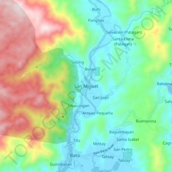
Name: San Miguel topographic map, elevation, terrain.
Location: San Miguel, Catanduanes, Bicol Region, 4801, Philippines (13.60033 124.26311 13.68033 124.34311)
Average elevation: 226 m
Minimum elevation: -5 m
Maximum elevation: 670 m
Other topographic maps
Click on a map to view its topography, its elevation and its terrain.
Mabato
Philippines > Catanduanes > San Miguel
Mabato, San Miguel, Catanduanes, Bicol Region, Philippines
Average elevation: 187 m