
Granite topographic map
Interactive map
Click on the map to display elevation.
About this map
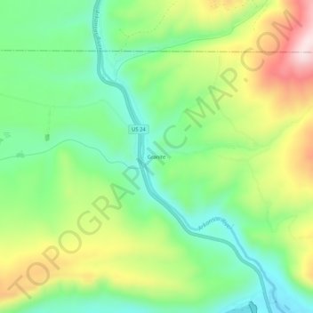
Name: Granite topographic map, elevation, terrain.
Location: Granite, Chaffee County, Colorado, 81228, United States (39.02360 -106.28336 39.06360 -106.24336)
Average elevation: 2,841 m
Minimum elevation: 2,690 m
Maximum elevation: 3,088 m