
San Agustin topographic map
Interactive map
Click on the map to display elevation.
About this map
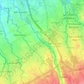
Name: San Agustin topographic map, elevation, terrain.
Location: San Agustin, Dasmariñas, Cavite, Calabarzon, Philippines (14.29393 120.93428 14.32495 120.96518)
Average elevation: 117 m
Minimum elevation: 81 m
Maximum elevation: 158 m
Other topographic maps
Click on a map to view its topography, its elevation and its terrain.