
San Francisco topographic map
Interactive map
Click on the map to display elevation.
About this map
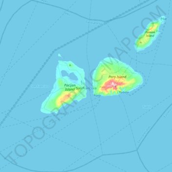
Name: San Francisco topographic map, elevation, terrain.
Location: San Francisco, Cebu, Central Visayas, Philippines (10.45057 124.15581 10.84997 124.42029)
Average elevation: 8 m
Minimum elevation: -1 m
Maximum elevation: 365 m
Lake Danao is a freshwater lake located in the northern part of Pacijan Island, about 4.9 kilometres (3.0 mi) long and 1.8 kilometres (1.1 mi) wide, with an elevation of 5 metres (16 ft) above sea level. Its area of 680 ha (1,700 acres) makes it the largest lake not only in the province but also in the Visayas regions. It has two interior islands which can be reached by paddleboat or as part of the scenic lake cruise. An 18-kilometre (11 mi) hiking and cycling trail encircles the entire perimeter of the lake. Although classifies as "freshwater", that doesn't necessarily make it suitable for irrigation. A 2015 study determined which crops could be sustained.