
Ronda topographic map
Interactive map
Click on the map to display elevation.
About this map
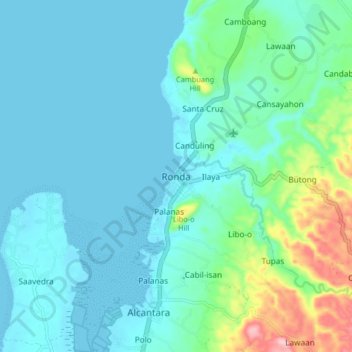
Name: Ronda topographic map, elevation, terrain.
Location: Ronda, Cebu, Central Visayas, 6034, Philippines (9.95914 123.37141 10.03914 123.45141)
Average elevation: 41 m
Minimum elevation: -2 m
Maximum elevation: 218 m